From the rugged highlands of Scotland to the chalk downs of southern England, Britain's geography tells a story millions of years in the making. We help organizations, educators, and curious minds decode the patterns etched into our island's terrain.
In an age of digital maps and satellite imagery, the deeper understanding of place has become paradoxically rare. We can locate anywhere instantly, yet comprehend nowhere fully. Geography is not merely where things are—it's why they are, how they became, and what they mean for communities shaped by terrain, climate, and geological inheritance.
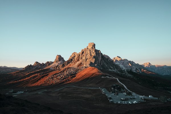
Britain's compact size belies its extraordinary geographical diversity. Within these islands lie contrasts that would typically span continents: ancient mountain ranges worn to stumps, limestone pavements sculpted by millennia of rain, coastal cliffs revealing the secrets of prehistoric seas.
Every landscape holds layers of information that trained eyes can read like text. Soil composition reveals agricultural potential and historical land use. River patterns expose underlying geology. Settlement locations telegraph centuries of human response to topographical opportunity and constraint.
Our approach draws on field research, cartographic analysis, and direct observation to build complete geographical profiles. Whether you're planning educational curricula, assessing regional development potential, or simply seeking to understand the land beneath your feet, geographical literacy provides foundational insight.

Comprehensive analysis of specific regions covering topography, hydrology, soil composition, and human-environment interaction patterns.
Custom geography curricula designed for schools, universities, or public education initiatives with field study components.
Expert guidance on map creation, spatial data visualization, and geographical information presentation for reports and publications.
Detailed recording and interpretation of sites of geological interest, suitable for conservation planning or heritage designation applications.
Analysis of how geographical factors influence or constrain development, agriculture, and environmental management decisions.
"The regional assessment provided clarity we couldn't have achieved internally. Their ability to connect geological data with practical implications for our planning work was exceptional."
— Planning consultant, Hampshire County Council
"Working with their team transformed how our students understand local geography. The field study component they designed became the highlight of our curriculum."
— Geography department head, secondary academy
Select a service above, then complete this form to start a conversation about your geographical research or educational needs.
Geography remains the discipline that connects physical reality to human experience. Whether your interest lies in education, planning, conservation, or simply understanding the forces that shaped the ground you walk on, geographical insight provides a foundation that other fields assume but rarely examine.
Explore all services in detail →